Story of a Thesis, Part 4: Maturation
(This is the fourth installment of a multi-part post detailing my undergraduate thesis. See part one, part two, and part three.)
As I continued my research into Venture Smith’s life as a free man, GIS allowed me to construct a visual narrative of his forty years in Haddam, CT. After reconstructing each of his real-estate transactions, I was left with a surprisingly nuanced and revealing portrait of a free black man riding the tumultuous waves of Revolutionary and post-Revolutionary New England. In this post I will present a selected sample of some of these recreated transactions, and briefly discuss what they reveal about Smith’s life and the broader world in which he lived.
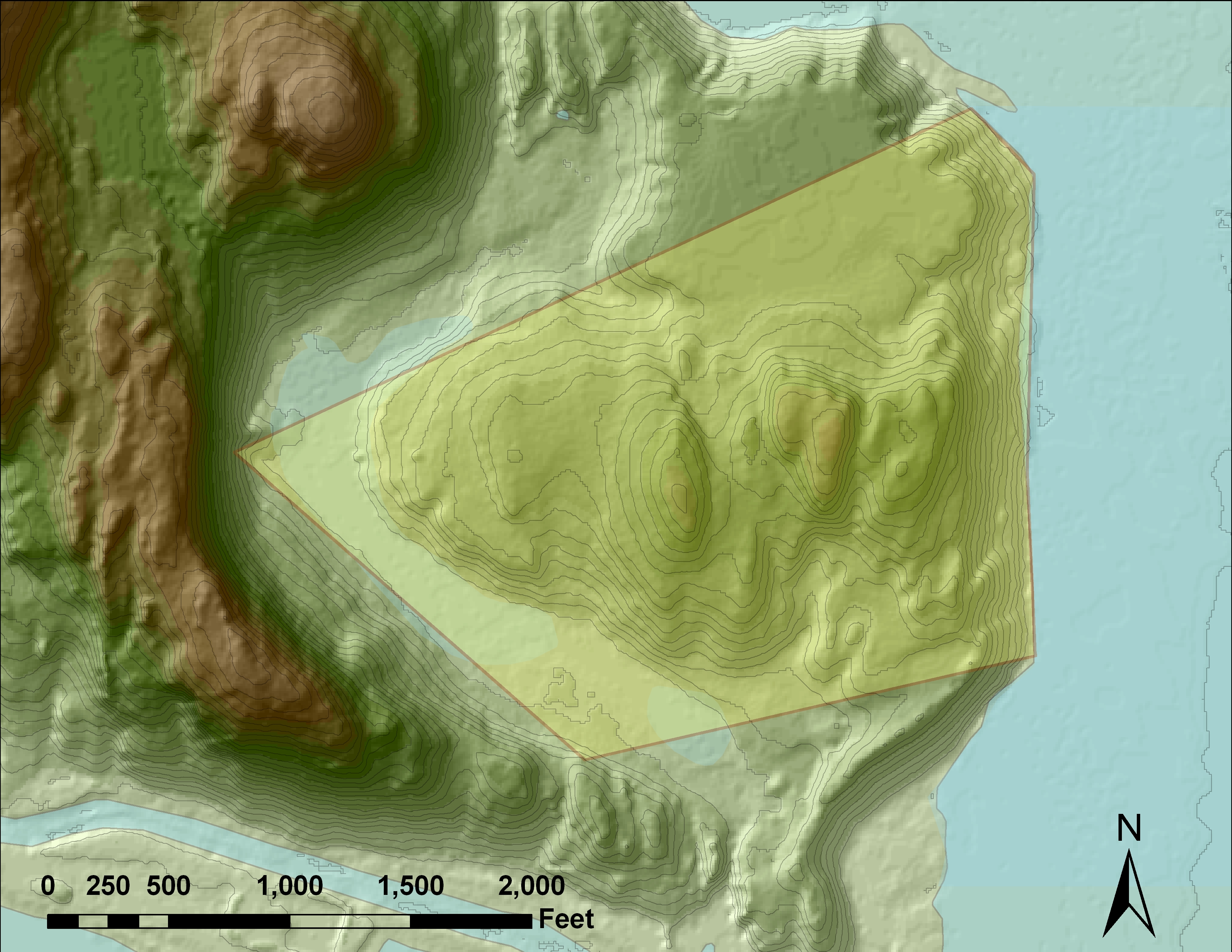
By 1778, Smith had gone from the owner of a meager ten-acre parcel of low-quality land, to the proprietor of a sprawling 128 acres:
The fifty year-old Smith faced the enviable prospect of having simply too much land to effectively use. Consequently, later that year he sold a twelve-acre tract to two free black men named Whacket and Peter:
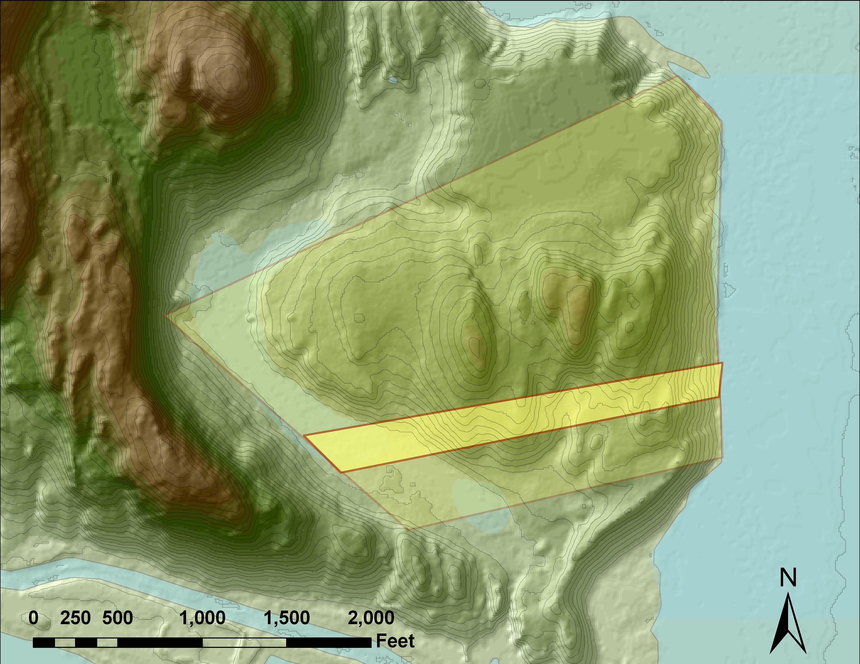
In effect, the modest real-estate transaction provided Smith with four additional laborers for his land (Whacket, Peter, and their two wives), while allowing him to recreate a semblance of black communal life in an overwhelmingly white town and region. On several occasions in his narrative, Smith mentions buying the freedom of slaves. In exchange, the men would work under Smith for a period of time. His sale of land to Whacket and Peter marks yet another instance of utilizing black labor, possibly in the tradition of “pawnship,” a West African practice described by Paul Lovejoy and David Richardson. The 1778 real-estate transaction offers a glimpse into both the economic and social motivations of a black man deftly maneuvering within a white world.
Another revealing transaction occurred in 1787, when Smith embarked on a joint business venture with a local man named William Ackley. Smith leased a small island in the nearby Salmon River to Ackley, and in the deed, spelled out with precise detail a contract for the two men to construct a fishing seine on the island. The enterprise was divided equally, with each man supplying half the labor and equipment, including lead, hair for ropes, twine for nets, a boat, and general repairs. In attempting to geographically locate this deed, I turned yet again to GIS. The deed spelled out its locations as “off of Beaver Point.” After finding a nineteenth-century map that labeled Beaver Point, I knew roughly where the island was. Unfortunately, the GIS datasets I had been using didn’t adequately portray the island. This time, I employed aerial photographs of the region in order to locate the island:
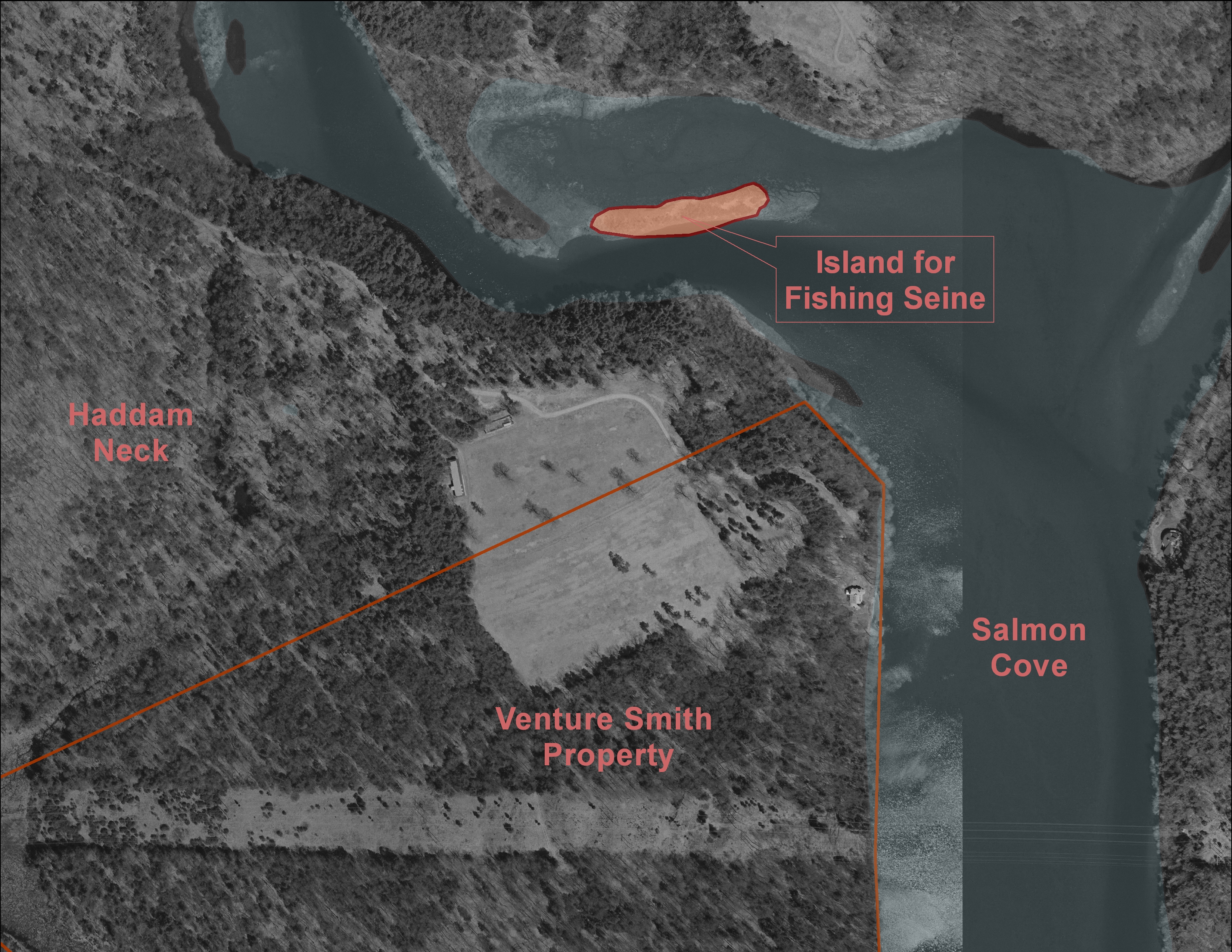
As is often the case, GIS offered up as many questions as answers: The island wasn’t entirely contiguous to his property, so how did Smith come to own its leasing rights? Was it a clause within a previous land deed, or was it an entirely separate transaction? I never found answers to these questions, and this investigative process provided me with the valuable (and frustrating) realization of the limits of historical inquiry. Instead, what the transaction did reveal was the phenomenally diverse activities of an independent property owner in the eighteenth-century. Beyond fishing in the river, Smith engaged in prolific woodcutting, tended an orchard, raised livestock, and engaged in trade throughout southern Connecticut and Long Island Sound.
Of course, as with almost any rural inhabitant with a large tract of land, Smith was a farmer. In order to investigate his agricultural pursuits (which both deeds and court files allude to), I looked for farming data I could use in GIS. Fortunately, the US Department of Agriculture created an extensive dataset of soil quality data for the state of Connecticut. I imported this data into GIS and overlaid it onto Smith’s property, creating a precise summary of Smith’s agricultural activity:
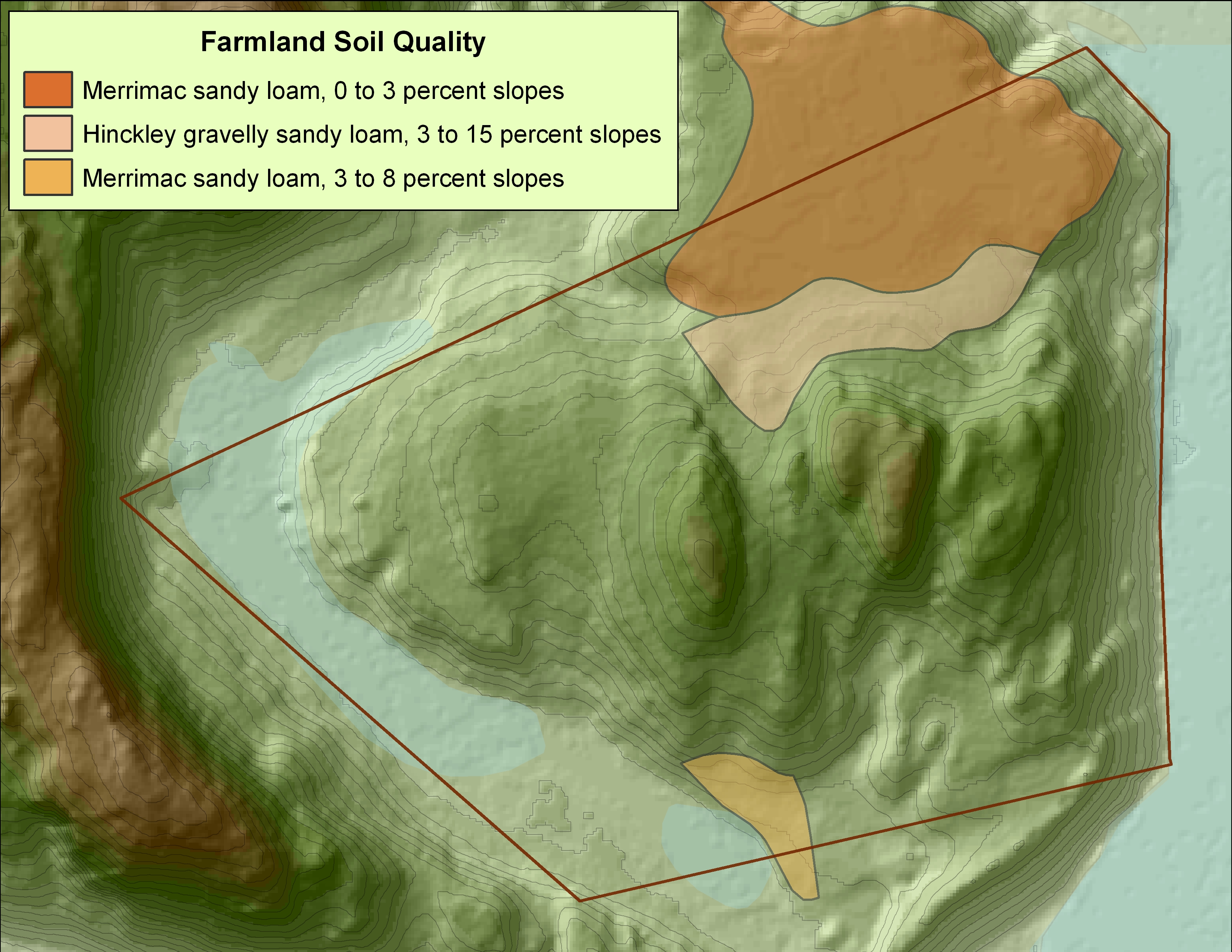
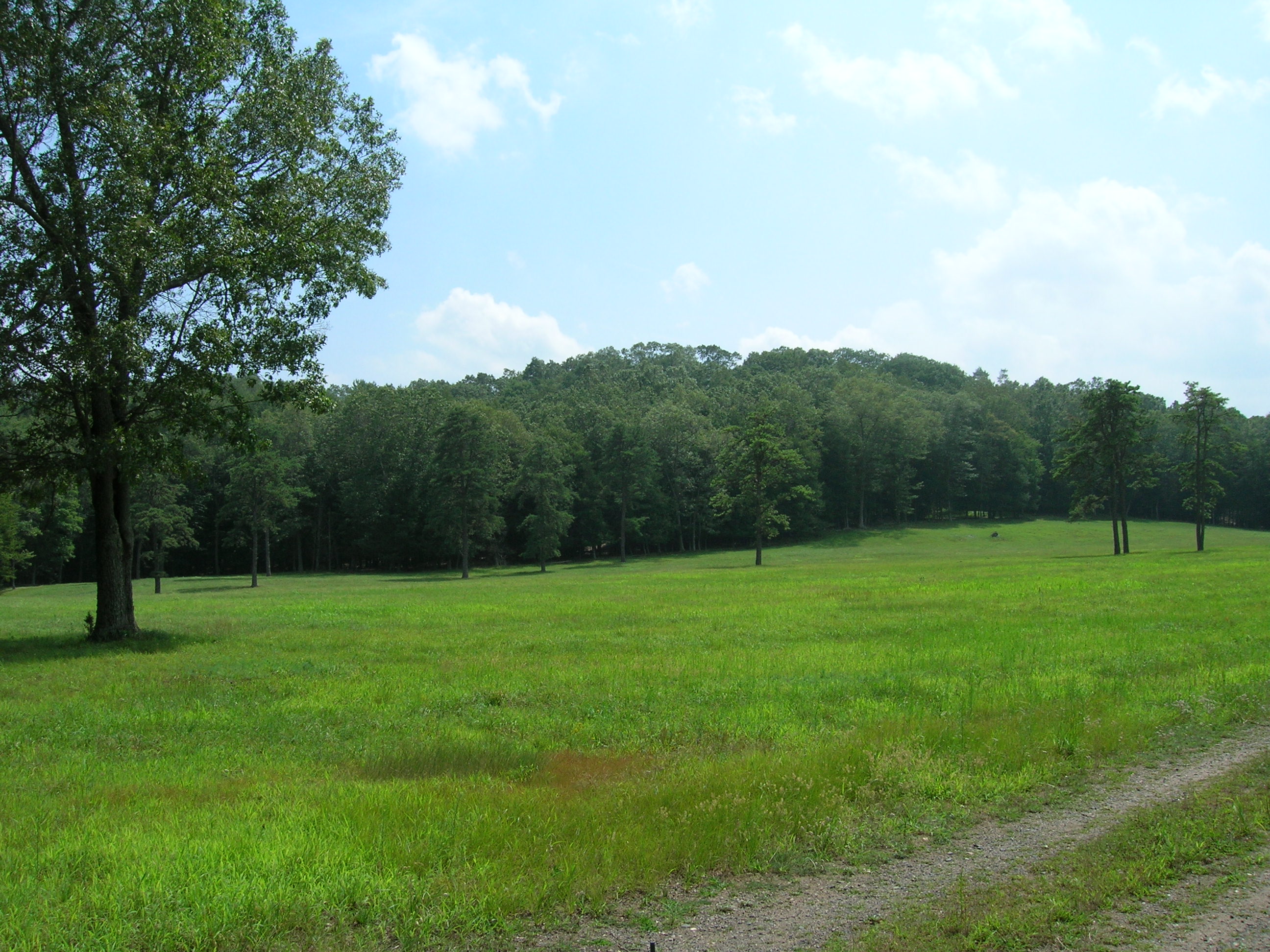
I filtered the data to isolate only high-quality soil well-suited for farming. Two factors go into this characterization: the slope of the land, and content of the soil. Armed with this information, I found that Smith enjoyed a particularly rich area of farmland in the upper region of his property. I could personally attest to the suitability of this area, as I had walked through it several times:
The land lent Smith with several advantages. It was a short walk to both his homestead and the Salmon River, allowing for easy access, storage, and transportation of goods. In lieu of employing an official currency (which was famously wracked with inflation at the time), Smith, along with much of the rural populace, often utilized goods and produce as a means of exchange. His lucrative pasture provided him and his family with not only sustenance, but a means of obtaining goods with which to participate in the regional economy. As a black man and former slave, his land granted him with a critical foothold within the dominant economic framework of rural New England.
Without GIS, I never would have been able to effectively analyze the relationship between Venture Smith’s freedom and his property. Instead of making abstract conjectures based solely on written primary documents, I was able to add a visual and quantitative element to my investigation. Suddenly I could answer with precise and revealing detail the questions of where, what, how much, and to what degree. I could now recognize patterns, rebuild processes, and craft a visual construction of Smith’s land. With GIS at my fingertips, “ten acres of land” no longer a set of words on a yellowed property deed, but became a deeply nuanced story of where and what the land consisted of, how it reflected and revealed Venture Smith’s motivations and decisions as a free man, and finally his place within the wider world of late eighteenth-century rural New England.