Story of a Thesis, Part 2: Birth
(This is the second installment of a multi-part post detailing my undergraduate thesis. See part one, part three, and part four.)
The need to specialize is a lesson that any undergraduate history major is forced to confront at some point in their studies. I learned this lesson early on in the summer after my sophomore year, when I came to understand the wide extent of the scholarly community who, like me, was studying Venture Smith. In order to find my specialty within this community, I turned to the most obvious starting place: his widely-read narrative.
The one aspect of Smith’s narrative that struck me again and again was his near-obsessive focus on money. Dictated at the age of sixty-nine, the elderly and ailing grandfather managed to recall the exact prices of financial transactions from three or four decades in the past. Scholars such as David Waldstreicher and Philip Gould have written articles about Smith’s sometimes-disturbing commodification of just about everything, including relationships with family members. As an example, on two separate occasions he mourns the death of a child not only with grief, but an exact recounting of how much money their deaths cost him. This narrative theme offers up room for fascinating historical inquiry - had Smith deeply internalized early American capitalist values? Was it a reflection of his childhood experience in Africa, when he witnessed his father tortured to death while refusing to tell his captors where he had hidden his money?
These questions, while interesting, had already been asked and discussed by scholars. Instead, Smith’s exacting financial memory offered up another opportunity. Included in these transactions were several scattered remarks concerning property purchases and sales. Some of these memories included not only a location, but the seller/buyer and sometimes the price as well. I quickly recognized this might be my opportunity for completing something original. So I drove to the town vault of Haddam, Connecticut, and immersed myself within their land records with the happy abandon of someone who was quickly discovering the addictive appeal of archival investigation. After some searching, I managed to find Smith’s first real-estate purchase in the town, when he bought 10 acres of land from a man named Abel Bingham for twenty pounds in the spring of 1775:
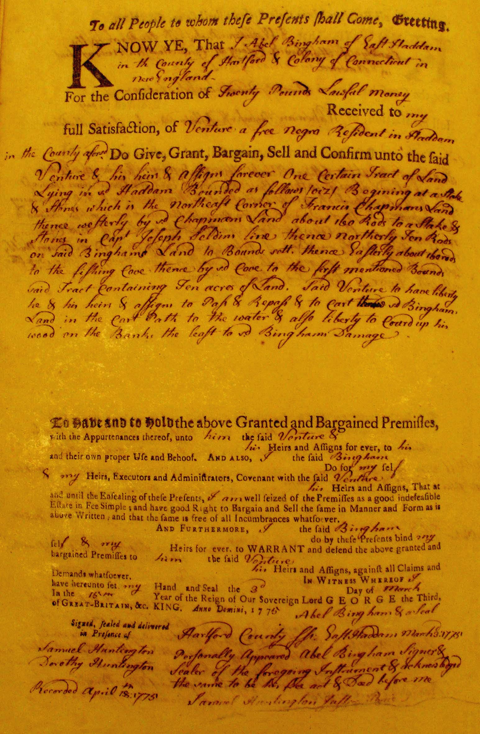
I have always known that I was a nerd. But nothing drove home that point more than when I let loose an involuntary and decidedly undignified fist-pump upon turning the page and seeing “Venture a free negro Resident in Haddam” written on the yellowed page. The thrill of discovery, the firecracker string of additional questions that immediately rose with each new piece of evidence - I was hooked. This is what I wanted to do.
Over the course of a week or two, I spent most of my days in the cramped quarters of the Haddam town hall vault, flipping over crackly pages underneath a horrible fluorescent light. I quickly decided to transcribe every deed I could find, which, while laborious, felt like the scholarly thing to do. And during this time, I learned the frustrations and rewards of working with 230 year-old documents. Deed indices, while occasionally helpful, were often incomplete or inaccurate. Venture Smith’s name could be spelled any way from “Venter” to “Vinter” to “Ventur,” and varying had either his surname or simple “negro,” “free negro,” or “a resident in Haddam.” And while transcribing was usually fine, there were several occasions when I labored over a string of words that I simply could not decipher.
As I typed all of these deeds (at the final tally, I found 29 land deeds that bear Smith’s name), I found myself wondering what exactly these pieces of property might look like. Fortunately, I was lucky enough to have a real-life idea, as I had been tagging along once a week with the archaeological team that was excavating his homestead:
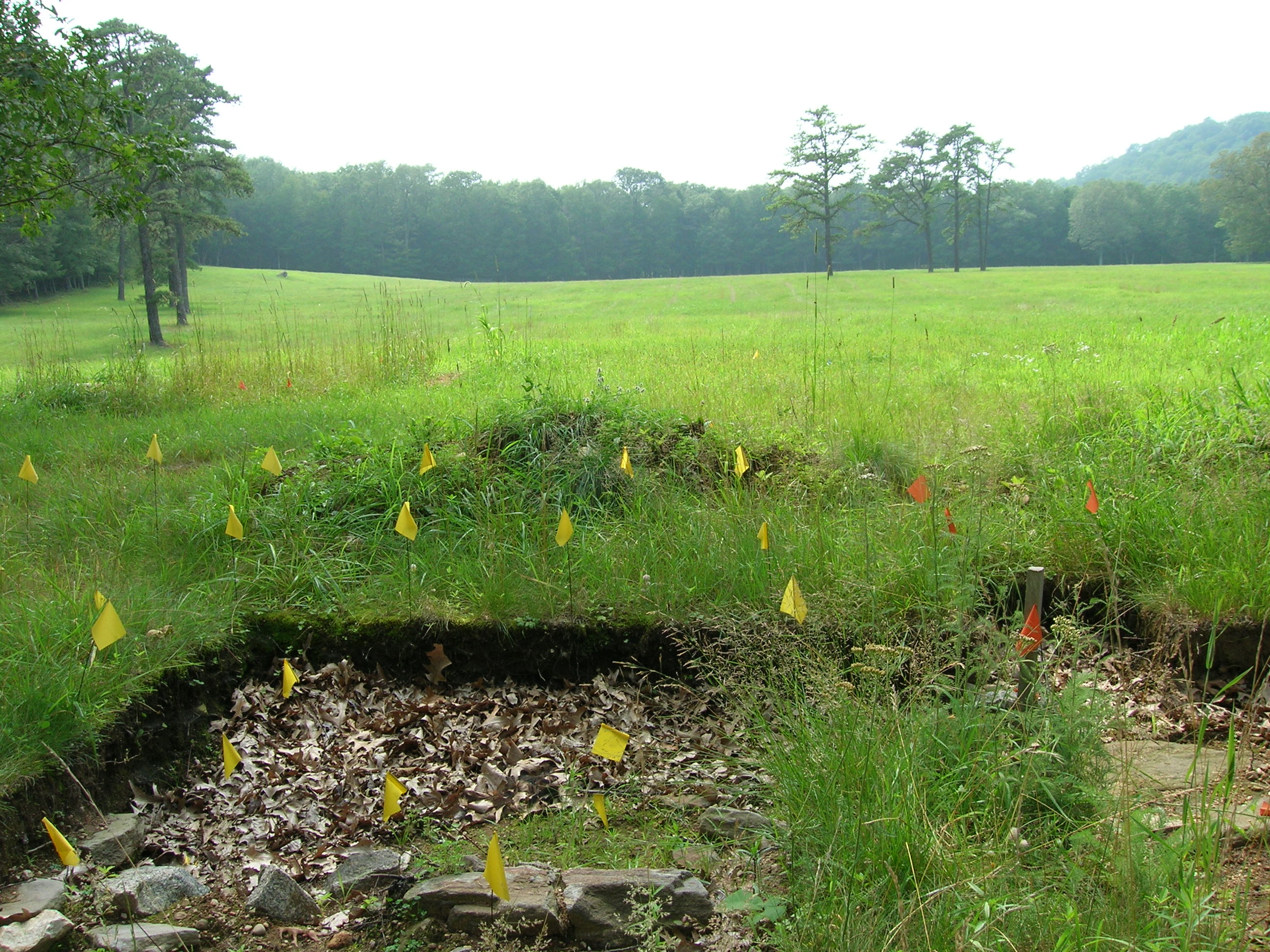
In exchange for granting me access to the property (as I mentioned, it was on the site of a decommissioned nuclear power plant), I did my best to help out and learn the rudiments of archaeology. Of course I likely did more harm than good, as to my untrained eye, most pieces of pottery tended to look exactly like rocks to be tossed aside. Regardless, the experience made me wonder exactly which transactions referred to what parts of his property.
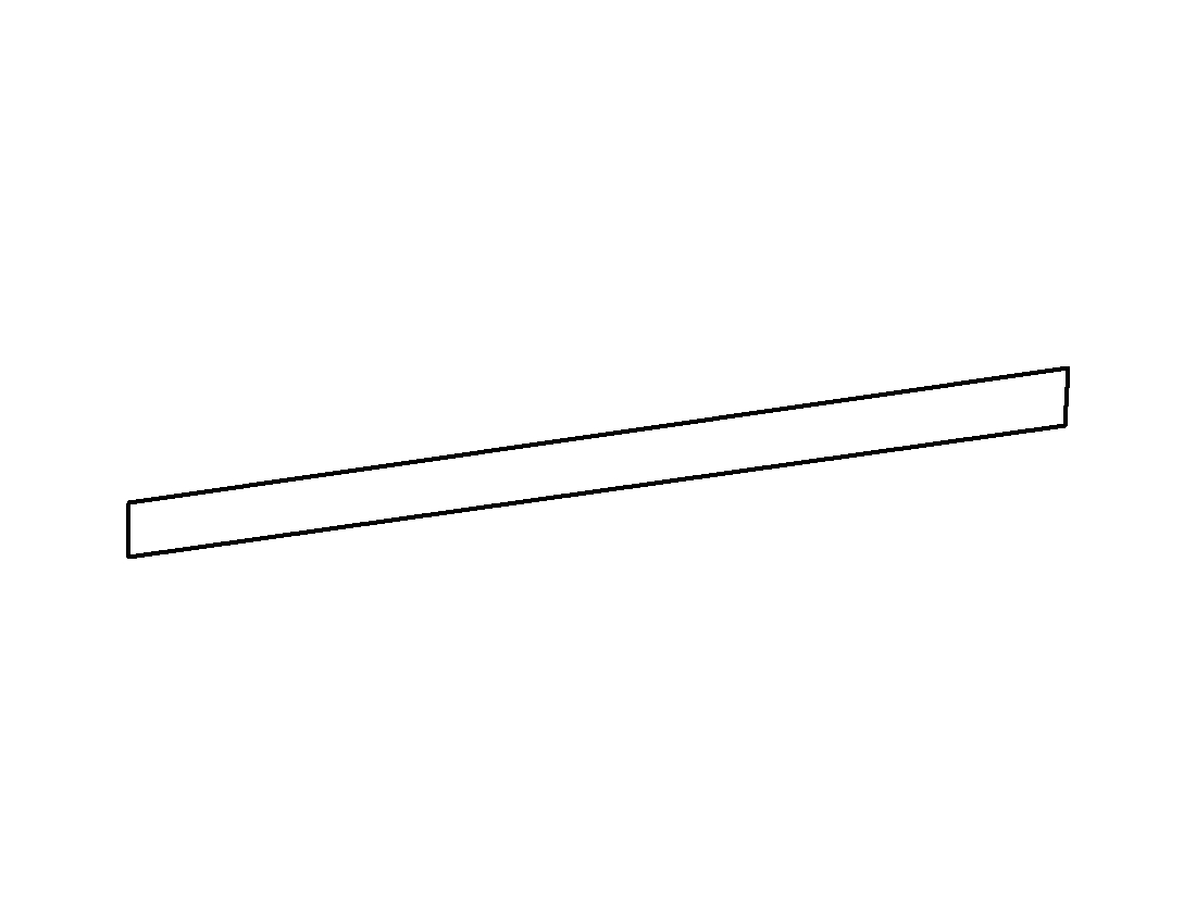
The land deeds used a metes-and-bounds system of measuring the parcels in question, whereby the description would start at one corner of the land’s boundaries, and follow the edges until it met back up at the point. The standard for measuring length were rods (1 rod = 16.5 feet), with direction given either in exact degrees (ex. “sixteen degrees north of south”), or with less precision (ex. “northerly along Abel Bingham’s land”). So one day I decided to sit down with a pencil, ruler, and protractor, and draw out these pieces of real estate. It was strangely therapeutic to become wrapped up in a quantitative exercise of units, conversions, and angles, after countless hours dealing with written words. Of course, my end result was far from ground-breaking:
After completing a few more of these drawings, I became frustrated. Not only was it time-consuming, but my attempts to put it onto a paper map largely failed - issues of transparency, scale, and unit conversion tripped me up repeatedly. But I was still obsessed with the problem: where were these pieces of property, and what did they look like? This frustration with the inadequacies of pencil and paper ultimately drove me into the arms of a digital technology that would widen my perspective on the possibilities of historical research: Geographic Information System (GIS).