Post Offices by State, 1867-1902
Below is a Tableau visualization showing the number of post offices in each state for each year. Note that the visualization is a quick-and-dirty approach that uses modern political boundaries. This causes particular problems with western territories. North and South Dakota, for instance, were grouped as Dakota Territory until 1889 while Oklahoma peeled off from “Indian Territory” in 1891. Information for these pre-modern-statehood areas are not visualized on the map, but the full dataset can be downloaded here.
I am interested in what patterns you might find, so please post any and all observations in the comments section below!
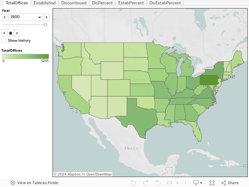
Tab descriptions:
- TotalOffices: number of post offices in that state for that year
- Established: number of post offices established during that year
- Discontinued: number of post offices discontinued during that year
- DisPercent: discontinued post offices as a percentage of total post offices
- EstabPercent: established post offices as a percentage of total post offices
- DisEstabPercent: combined established and discontinued post offices as a percentage of total post offices.
Source: The Annual Report of the Postmaster General, from 1867-1902. (Example page) Date Created: 8/28/2012 Date Modified: 8/28/2012
 Post Offices By State, 1867-1902 by Cameron Blevins is licensed under a Creative Commons Attribution-NonCommercial-ShareAlike 3.0 Unported License. Based on a work at http://cameronblevins.org/postal-data/#officesByState.